
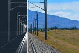
The Mapa Limak CRRC Consortium is using high-precision surveying and BIM workflows to support construction of Dubai’s 30km Blue Line.
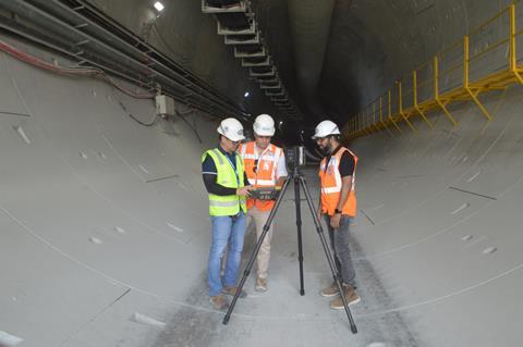
The surveying team supporting Dubai Metro’s Blue Line expansion has used 3D laser scanning to capture high-accuracy data from existing stations and infrastructure, achieving positional accuracy of less than 5mm.
Led by Senior Survey Manager Murat Pehlivan, the team used a Topcon CR-P1 3D laser scanner alongside a GT-1200 robotic total station to produce detailed point clouds for the Mapa Limak CRRC Consortium. The data is being used to support construction activities, engineering design and Building Information Modelling (BIM) coordination.
The Dubai Metro Blue Line is currently under construction and is scheduled to open in September 2029. The approximately 30km route will feature 14 stations, including underground and elevated sections, as well as Dubai Metro’s first bridge crossing over Dubai Creek.
Surveying existing infrastructure
The project requires new infrastructure to connect with Dubai’s existing metro network. As part of the surveying campaign, Pehlivan’s team scanned Creek and Centrepoint stations, formerly known as Rashidiya, which are currently served by the existing Green and Red lines.
Each station covers approximately 13,000 to 14,000 square metres. The team also surveyed the R11 multi-storey parking structure, which covers approximately 150,000 square metres. Both internal and external areas were captured, including entrances, access gates, footbridges, parking areas and bus movement zones.
Rather than relying solely on conventional surveying techniques, the team selected 3D laser scanning to capture large and complex structures within a shorter timeframe. Data processing was carried out alongside scanning, allowing point clouds to be prepared while field activities continued.
The resulting data is being provided to the consortium’s Design and BIM teams, where existing structures can be compared with proposed infrastructure. This allows discrepancies between existing models and physical conditions to be identified before they create problems during construction.
“Having an accurate coloured 3D model of all structures is what makes the 3D scanning data valuable,” Pehlivan said. “Superimposing the scan data with the design data enables us to detect even the smallest discrepancies.”
Reducing surveying time
The CR-P1 was selected following an evaluation of available scanning technologies, with the team particularly interested in its combination of speed, accuracy and field-processing capabilities through Topcon Collage Site software.
The software allows surveyors to process and review georeferenced point clouds directly in the field. This meant potential problems could be identified immediately, allowing affected areas to be rescanned without requiring a later site visit.
According to Pehlivan, the technology also produced substantial productivity improvements. Work that could previously have required a three-person team operating across two shifts for up to six months was completed in three months by a two-person team working a single shift, reducing labour requirements by approximately 60%.
The team used the GT-1200 total station to establish and transfer high-accuracy control points before scanning. This was particularly important where new and existing structures needed to be aligned within the same project environment.
Scanning activities at operational stations also had to account for passenger movements and site restrictions. Much of the work was therefore scheduled during off-peak periods to maintain data quality while limiting disruption.
Supporting the wider Blue Line
The surveying work will extend beyond existing stations as construction progresses, with future scanning activities expected to cover tunnels, viaducts and new stations.
The Blue Line is intended to improve connectivity for rapidly developing areas of eastern and northeastern Dubai that have historically had limited direct metro access. The project is expected to reduce journey times, improve access to employment and education, and reduce pressure on major road corridors.
It will also feature a new elevated station at Dubai Creek Harbour, planned to reach 74 metres in height, alongside the network’s first bridge crossing over Dubai Creek.
For the surveying team, the project demonstrates how digital data capture can support complex infrastructure development by improving coordination between existing conditions, engineering designs and construction requirements.
Pehlivan said the ability to capture, process and verify information on site was particularly valuable for a project operating under tight schedules and demanding accuracy requirements.
The combination of laser scanning, robotic surveying and BIM integration is therefore helping the Blue Line team establish a detailed digital representation of existing infrastructure before connecting it with the new railway

No comments yet