SMART Surveying
Posted: 4 August 2010 | | No comments yet
Sonoma-Marin Area Rail Transit (SMART) is an overwhelmingly popular rail initiative in Northern California and is to begin service in 2014. Planners estimate that the new commuter rail system can be built for approximately $7.1 million dollars per mile, which compares very favourably to the cost of extending other local systems.
The Northwestern Pacific railway corridor has been out of service since 1994. The right of way is overgrown in many areas, two existing tunnels will need to be refurbished and the entire track will be redesigned and replaced. One of the first steps in the redesign of the track, is an accurate survey of the existing 70 miles of track. This means good coordinates at regular intervals on both rails. Planners and designers needed to know the location, super-elevation, gauge (distance between the rails), location of switches, etc. This is a major undertaking.
Sonoma-Marin Area Rail Transit (SMART) is an overwhelmingly popular rail initiative in Northern California and is to begin service in 2014. Planners estimate that the new commuter rail system can be built for approximately $7.1 million dollars per mile, which compares very favourably to the cost of extending other local systems. The Northwestern Pacific railway corridor has been out of service since 1994. The right of way is overgrown in many areas, two existing tunnels will need to be refurbished and the entire track will be redesigned and replaced. One of the first steps in the redesign of the track, is an accurate survey of the existing 70 miles of track. This means good coordinates at regular intervals on both rails. Planners and designers needed to know the location, super-elevation, gauge (distance between the rails), location of switches, etc. This is a major undertaking.
Sonoma-Marin Area Rail Transit (SMART) is an overwhelmingly popular rail initiative in Northern California and is to begin service in 2014. Planners estimate that the new commuter rail system can be built for approximately $7.1 million dollars per mile, which compares very favourably to the cost of extending other local systems.
The Northwestern Pacific railway corridor has been out of service since 1994. The right of way is overgrown in many areas, two existing tunnels will need to be refurbished and the entire track will be redesigned and replaced. One of the first steps in the redesign of the track, is an accurate survey of the existing 70 miles of track. This means good coordinates at regular intervals on both rails. Planners and designers needed to know the location, super-elevation, gauge (distance between the rails), location of switches, etc. This is a major undertaking.
A new way of rail surveying
“We worked on the railroad in the past, with SMART’s lead consultant; HDR Engineering,” says James M. Dickey, PLS, President of Cinquini & Passarino Inc. (CPI), a survey firm based in Santa Rosa, California. “We knew from our previous experience that the top of rail survey could take months to complete with conventional surveying equipment.”
CPI was asked to provide details of track and crossing conditions for a northern 60 mile section of the SMART corridor, with rail information at 100 foot stations. With conventional RTK or optical surveying, the work goes slowly and it’s hard to reliably get sufficient accuracy. Setting and plumbing the rod at consistent points on the rounded top surface of rails is tedious. And, counting off stations along the track adds up as well. CPI wanted to work more efficiently, while providing higher density and more accurate information to their client.
True to form, CPI came up with a better idea for the SMART corridor work. “The project was qualifications-based and we had to figure out the best way to meet project goals. We were challenged with a very tight time schedule,” he explains. “We saw some information on the Amberg Technologies’ GRP System FX track surveying system in The American Surveyor (April 2009 issue), and we thought it might work perfectly for this.”
Amberg Technologies’ (Regensdorf, Switzerland) rail and tunnel solutions are well established in Europe and Asia, but are just being introduced to the United States. Dickey asked the Kara Company, Inc. (Countryside, IL), Amberg’s U.S. distributor, to demonstrate the system, which is based on a three-wheeled instrument that rides along rails. The GRP is equipped with extremely precise sensors that continuously measure track gauge and superelevation, as well as an odometer for relative stationing. The horizontal and vertical alignment of the track is established by streaming position data (N, E, Z) to the GRP from either a Leica robotic total station or RTK GPS. All of the data are simultaneously managed in the onboard Amberg Rail software. In practice, the GRP is pushed along the track and in a single process, provides all track information. Depending on how it is configured, the GRP System FX can also be used for real-time track adjustment in slab track construction (used in high-speed and light rail projects), tamping surveys for ballasted tracks, real-time clearance analysis and 3D mobile laser scanning.

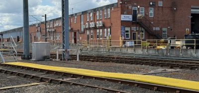
Surveying with GRP 1000 from Amberg Technologies: collection of horizontal track location, top of rail elevation, gauge and super-elevation in one process
“The Kara Company provided training for the system,” says Dickey. “We trained four people – two field guys and two office guys – which took about a week. Once we learned the software, the field work went very efficiently.”
For this project, the GRP’s horizontal and vertical positioning was provided by RTK GPS. A Leica GX1230 receiver was connected via cellular modem to the California Surveying Virtual Survey Network (CSVSN). The CSVSN covered the SMART corridor and allowed CPI to start work each morning without setting up a base station or stopping every few miles to move the base station forward.
The only GRP-specific set up needed was a daily calibration of the cant sensor, which measures the super-elevation of the track. The calibration takes only a couple of minutes and works much like checking any level: the GRP is set on the track, a measurement is taken, then the GRP is turned the opposite direction (one person can do this) and a new measurement is taken and automatically evaluated by the on-board software.
Although the GRP only requires one person to operate, a two-man crew was used on this project for safety reasons. CPI had estimated that the time required to complete this survey with traditional methods would have been three months. The GRP enabled CPI to cover five to nine miles a day and complete the fieldwork for the entire 60 mile corridor survey in just under two weeks.
Mike Jones, who handled the office part of the project, and says that data was collected quickly enough to create a ratio of about two to one, fieldwork to office work. For deliverables, he exported points from the onboard Amberg data collector to a spreadsheet and then into AutoCAD–maps were simple, basically points and coordinates in parallel. With training, fieldwork, and office work, the entire project took about four weeks.
“The Amberg GRP saved us months of fieldwork,” says Dickey. “Plus, we could do more for our client. Since the GRP and GPS were gathering data more or less continuously, we were able to provide coordinates and track data at 25-foot stationing, rather than 100-foot. We now have all the data available to provide the track data at any other interval if requested by our client.”
Because it was new technology for CPI, Dickey made sure that spot checks were conducted with conventional equipment and found that the GRP consistently gave precise results.
About the Author
Angus W. Stocking
Angus W. Stocking, L.S., spent 17 years working as a land surveyor in several U.S. states, and as a right-of-way engineer for California’s Department of Transportation. Since 2003, he has written full time about infrastructure and construction around the world, and is one of the most widely published authors on these topics.