Humatics: Unlocking the future potential of digital rail
Posted: 27 July 2022 | Aaron Whittemore, Humatics | No comments yet
In this interview for Global Railway Review, Aaron Whittemore, Director of Product and Strategy at Humatics, explains the importance of the Humatics Rail Navigation System (HRNS) and how it will revolutionise rail for operators.
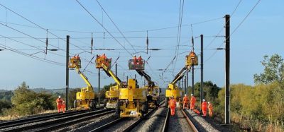
Wayside installation.
You just announced a successful project with Hitachi Rail in Naples, Italy – what was that project about and what comes next?
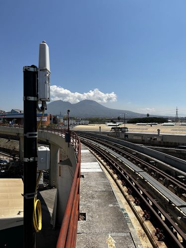
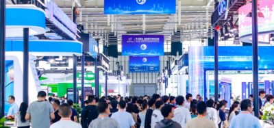
Deployed technology in Naples, Italy.
Hitachi Rail identified positioning and odometry as an area that can make use of next generation technology to reduce installation time, improve operations, reduce the total cost of ownership, and unlock advanced features unavailable with traditional solutions. After a competitive evaluation process, Hitachi selected the Humatics Rail Navigation System (HRNS) for evaluation. Humatics worked collaboratively with the Hitachi Rail team almost entirely remotely due to the pandemic. Together, we installed the HRNS over 1.5km of test track and on a test vehicle and integrated it with a CBTC emulator to simulate CBTC positioning capabilities.
Over 200 test runs were completed using Ultra Wideband (UWB), GNSS and IMU sensors to evaluate positional and velocity performance. At the conclusion of the evaluation the HRNS satisfied all performance expectations.
The collaboration between the two companies will continue as additional signalling applications involving commuter, freight, and light-rail, monorail, and automated people mover applications are being explored, additional sensors being evaluated, and new advanced features are being developed.
Can you explain what the purpose of the Humatics Rail Navigation System (HRNS) is?
Our robust algorithms allow a scalable, rapidly deployable solution that gives transport operators the opportunity to reap the benefits of signal modernisations faster than they would with traditional solutions.
The HRNS is a sensor fusion platform that uses the right sensors to solve the customer’s positional challenges. The primary solution uses UWB ranging, Inertial Measurement Units (IMUs) and GNSS data fused together to provide precise train localisation data such as position, speed, and acceleration that train control systems use to perform train control actions. The HRNS platform’s built-in flexibility accepts many different sensor types that can be used in conjunction with our sensor fusion algorithms, ensuring that the platform fits each customer’s technological and operational environment. The HRNS is a plug and play replacement for traditional odometry, helping reduce track side equipment (like balises and track circuits) and under-carriage devices while improving overall positional performance and reducing errors seen by legacy sensors (such as eliminating wheel adhesion issues related to slip and slide). Our solution also minimises commissioning and tuning time significantly. As an example, we recently deployed the system on two different track environments in two different countries with no software changes being required. Our robust algorithms allow a scalable, rapidly deployable solution that gives transport operators the opportunity to reap the benefits of signal modernisations faster than they would with traditional solutions.
What does a deployment of the HRNS look like?
At the very beginning of an engagement, we collaborate with the customer to understand their requirements and what we jointly need to accomplish. We then create a deployment plan consisting of the sensor suite to be used and the installation areas and guides for wayside and train-borne equipment. Wayside equipment installation plans can be developed using materials provided by customers which can be as good as high-resolution LiDAR scans and CAD drawings or as basic as readily available satellite imagery, while train-borne equipment guides can be created from CAD and images of the installation areas on the train.
A Radio Frequency survey is performed prior to deployment to characterise the operating environment. The results of the survey are relayed to the project team to determine what changes/adaptations might be needed to the equipment or installation to ensure the customer’s requirements are met. Equipment is then installed, and precise positional surveys are performed by Humatics, the customer or another contracted third party. Once this is complete, our localisation algorithms ingest the survey data and provide a digitisation of the train along the track while an easy-to-use API outputs real-time localisation data to the train control system or other systems like Passenger Information Displays.
What modes of transport is this applicable to?
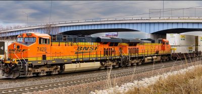
There is significant industry interest in being able to determine the position of work trains and other maintenance vehicles, establishing work zones and monitoring compliance.
The HRNS is being integrated with Communications Based Train Control (CBTC) systems for metro systems as the first core application. CBTC systems are largely deployed in underground environments where the HRNS shines, and we’ve performed rigorous analyses with our CBTC partners to show that operational improvements and cost reductions can be realised by agencies that replace traditional odometry with the HRNS. There is also direct applicability to other urban transport modes such as LRVs, which suffer from degraded GNSS based positioning as a result of urban canyons; these modes also benefit from HRNS wayside infrastructure being outside the track bed, as track bed solutions tend to be more disruptive to service and mixed traffic configurations. Similarly, mainline systems running the European Rail Traffic Management System (ERTMS) or Positive Train Control (PTC) in the United States would also benefit from the augmentation of known signalling standards, the reduction of undercarriage equipment and the improvement of GNSS provided by HRNS.
Secondary, non-localisation related applications of the HRNS should also be highlighted. For instance, information generated by the HNRS can be fed to driver assistance (DAS) and Passenger Information Display Systems (PIDS). Driver assistance information can be provided in a heads-up display showing the vehicle’s current position, speed, and allowable speed within that area. The HRNS data can then be used to create precise predictive arrival and travel times of vehicles. These can be fed to PIDS displays, providing passengers more accurate time estimates that will in turn allow them to better plan their commutes.
I would also add that the applicability of the HRNS goes beyond revenue service transport modes and applications. There is significant industry interest in being able to determine the position of work trains and other maintenance vehicles, establishing work zones and monitoring compliance.
In what ways do you think this technology will revolutionise rail?
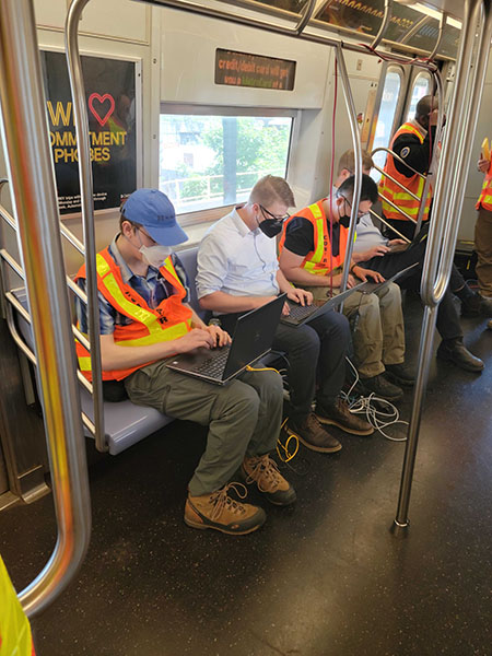
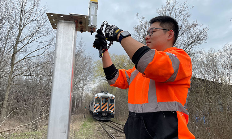
The Humatics team performing integration on a metro CBTC System.
Robust, precise positioning improves operations, increases capacity, and allows precision movements like interactions with platform screen doors with minimal infrastructure requirements. Multiple sensor solutions allow positional algorithms to leverage the strengths and mitigate the weaknesses of individual sensors ensuring a highly available, extremely precise position. Positioning is unaffected by adhesion issues that lead to wheel slip and slide, and can maintain high precision, high accuracy, and low uncertainty continuously throughout the system.
The immediate benefits transport operators can expect start with a faster installation, especially in retrofit scenarios where trains can be outfitted in four days instead of one month. The maintenance burden is reduced as train-borne equipment is easily accessible and doesn’t require maintenance depot bays and pits or lifts. Transponders in the middle of the tracks are eliminated allowing track maintenance and restorations to proceed without impacting signalling equipment.
The HRNS allows transit operators and signalling providers to unlock the future potential of digital rail. It is a sensor platform that allows the best, most advanced sensors to be used to solve the challenge at hand. The HRNS will continue to adopt maturing sensors seen in the autonomous vehicle industry such as LiDAR, radar, and vision systems. Precise positioning is the foundation for automation. Transit operators need to know where their trains are to be able to automate their movements within the environment in a safe and efficient manner. Automated yard operations, virtual platooning of light-rail and BRT vehicles, automated train rescue, and automated charging all require precise position to be successful. The HRNS can unlock these future possibilities and more.
Please visit Humatics at InnoTrans 2022 in Hall 6.1, Stand 119.
 Aaron Whittemore is the Director of Product and Strategy at Humatics. Previously, he was selected as a Harvard Business School Leadership Fellow, serving as the Director of Special Projects at the Massachusetts Bay Transportation Authority (MBTA) where he worked under the General Manager on a variety of business transformation projects, owned the Innovation Proposal Policy which evaluated and procured innovative products and services, and led capital improvement projects on signal, track, power and facility modernisations. Aaron was recognised as a 2019 Emerging Leader in Transportation from the NYU Rudin Center for Transportation. Prior to the MBTA, Aaron worked for over 10 years in complex system design and engineering serving as a Systems Engineering Leader with Raytheon on a variety of defence programmes.
Related topics
European Rail Traffic Management System (ERTMS), High-Speed Rail, Infrastructure Developments, Passenger Experience/Satisfaction, Safety, Signalling, Control & Communications, Technology & Software